Emergence of 1st Global Age |
Resources: Map 1
|
Lesson 1: 5 Fields of Social StudiesSocial Studies is not just a bunch of people, events, and dates organized by a time line. Each field should be thought of as a layer of paint on a canvas that is ever changing to make the world what it is today.
Social Studies can be more generally thought of as the stories of the people, the layout of the land, the people in power, the value of a dollar, and finally the beliefs and customs of a people. 1. History 2. Geography 3. Politics 4. Economy 5. Culture 4 Lessons Overview Social Sudies Lesson Resources 1 & 2 Day 1-Maps & Timelines Day 2-Maps of Space Day 3-Maps of Time Day 4-Identify which field, explain why |

Lesson 2: 5 Themes of GeographyGeography is one field of Social Studies in which the layout of the land is a major factor in the influence on the history, politics, economics, and cultures of a people.
There are generally 5 ways in which geography impacts our world and they are called themes. The 5 themes of Geography are movement, region, human-environmental impact, location, and place. 5 Lessons Overview Geography Lesson Resources Day 1- 5 Themes -Mr. Help Day 2-Our World Map Game Day 3-Types of Maps Practice Longitude & Latitude Understanding Regional Geography Continental Geography Study Cards Geographical Movement of People |
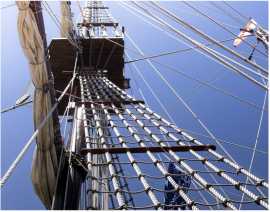
Lesson 3: Age of ExplorationInnovation and transportation transform global interaction.
Students should be able to: Identify specific examples of innovations & forms of transportation. Explain their long-term effects. Know the impact of the innovations by various individuals Identify specific individuals and their contributions Express how those innovations affected society Winds of Discovery Student Created SS Textbook |
Lesson 4: Renaissance, ARTS & Reformation

Students should be able to:
Define Renaissance Identify associated people. Explain the ideological movement. |

|
Lesson 1: 5 Fields of Social Studies Mastery Objectives:
Upon completing this unit the student will be able to:
1) Identify the temporal structure of a historical narrative or story.
2) Draw upon data in historical maps
3) Draw comparisons across eras & regions in order to define enduring issues, large-scale or long-term developments that transcend boundaries.
4) Obtain historical data from a variety of sources.
Historical Thinking Standards
1: Chronological Thinking: The student is able to (B) identify the temporal structure of a historical narrative or story.
2: Historical Comprehension: The student is able to (G) draw upon data in historical maps
3: Historical Analysis and Interpretation: The student is able to (D) draw comparisons across eras and regions in order to define enduring issues as well as large-scale or long-term developments that transcend regional and temporal boundaries.
4: Historical Research Capabilities: The student is able to (B) obtain historical data from a variety of sources
Lesson 2: 5 Themes of Geography Mastery Objectives:
Upon completing this unit, students will be able to:
1.) Differentiate among various flat world map projections in terms of their relative distortion of land shape and area.
2.) Identify the earth’s continents and describe alternative ways of naming them.
3.) Evaluate geographers’ opinions concerning the boundaries of continents and their relationships to each other and to bodies of water.
4.) Compare views of earth from different vantage points and identify several large regions as stages of world history
5.) Define continental drift and explain in general terms how global land masses came to be distributed as they are today.
6.) Analyze the relationship between vegetation zones, population distribution, and paths of interaction in historical time.
7.) Evaluate topographical features of earth in terms of their impact on the mobility of flora, fauna, and human beings.
Geography for Life: National Geography Standards The World in Spatial Terms
1. How to use maps and other geographic representations, tools, and technologies to acquire, process, and report information from a spatial perspective
3. How to analyze the spatial organization of people, places, and environments on earth’s surface Places and Regions
4. The physical and human characteristics of places
5. That people create regions to interpret earth’s complexity
6. How culture and experience influence people’s perceptions of places and regions Physical Systems
7. The physical processes that shape the patterns of earth’s surface
8. The characteristics and spatial distribution of ecosystems on earth’s surface Human Systems
9. The characteristics, distribution, and migration of human populations on earth’s surface Environment and Society
15. How physical systems affect human systems
16. The changes that occur in the meaning, use, distribution, and importance of resources The Uses of Geography
17. How to apply geography to interpret the past
